Field tools for hunters, on Android.

See where your scent drifts and which stand suits the wind. Check the light, the moon and the weather. Keep your places and your hunts in one app.

Get it on Google Play
  • Free, no ads
  • No account needed
  • Works offline
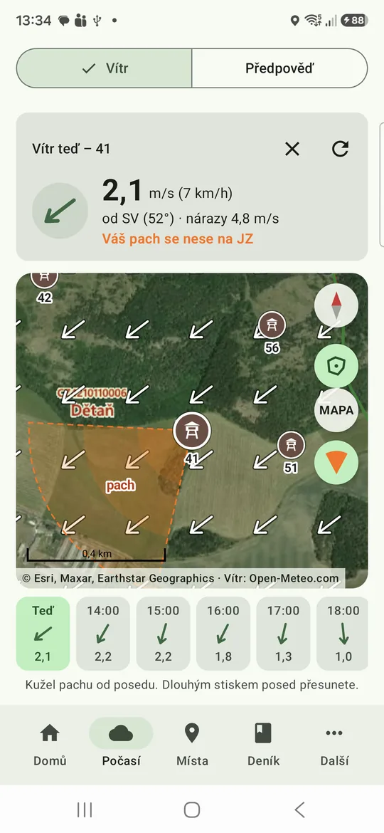
The wind map: wind arrows over a hunting ground, the saved stands, and an orange cone where the hunter's scent drifts.

Five tabs for the field

Everything is in five tabs at the bottom of the screen.

The screenshots show the app in Czech. The app is available in 24 languages.

Home

The hunt at a glance

The dashboard shows what matters before you go out: the wind now and the stands it suits, first and last light, the moon, and the weather with notes for the hunt.

A hunt in progress is at the top. With sharing on, you also see who from your group is out now. At the bottom are this hunting year's counts and the seasons that open or close soon.
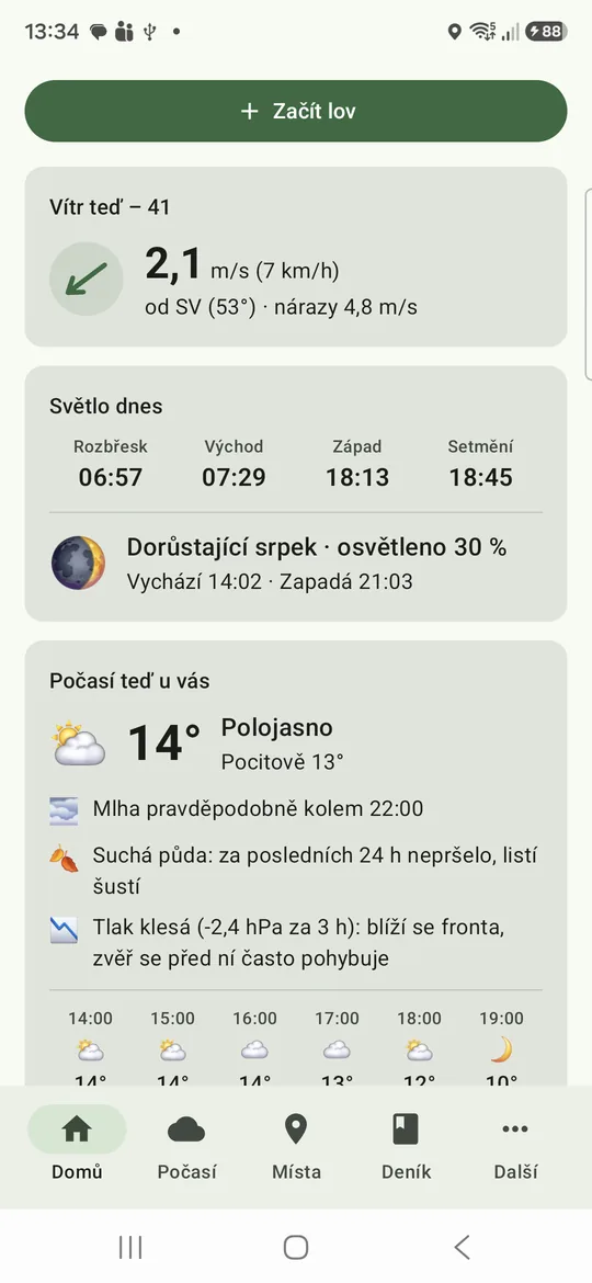
The Home tab: a Start hunt button, the wind now, today's light, the moon, and the weather with notes for the hunt.

Weather

The wind and the forecast

The wind map shows how the wind blows across your hunting ground. An orange cone shows where your scent drifts from the stand. Tap an hour in the strip below the map to see the wind later.

The forecast covers the next hours and days. It adds first and last light, the moon, the pressure trend, and notes on fog, frost and the ground underfoot.

The Weather tab with the wind: the wind now at the stand, the map with the scent cone, and the hour strip.

Places

Your hunting ground on a map

Save your stands, feeders, salt licks, bait sites and trail cameras. Tap the map, or save the spot where you stand.

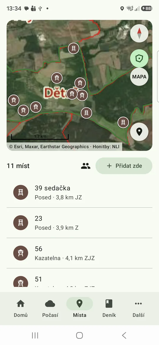
For each stand, mark the winds that suit it. The list shows how far each place is and which stands suit the wind now.

The Places tab: stands on a satellite map, and a list of places with their distance and direction.

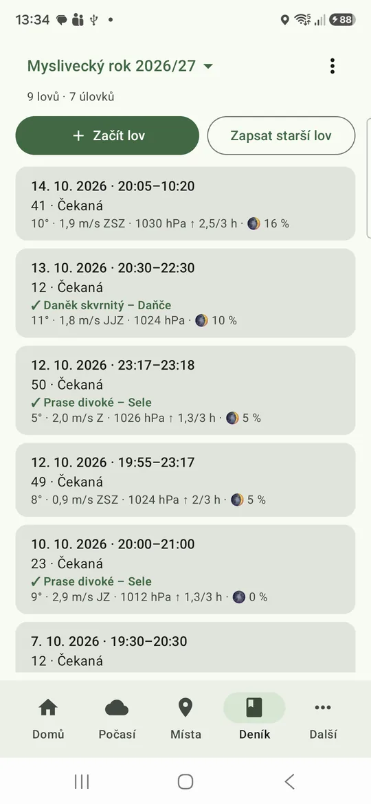
Log

Your hunts and kills

Start a hunt when you go out. Record what you saw, shot or found dead, mark it on the map and add photos. The weather is added automatically.

Send a kill report as a message, see the season summary, and export the log as a spreadsheet (CSV). In Czech, the log follows the official hunting records and knows the hunting seasons.

The Log tab: the hunts of the hunting year with their place, kills and weather.

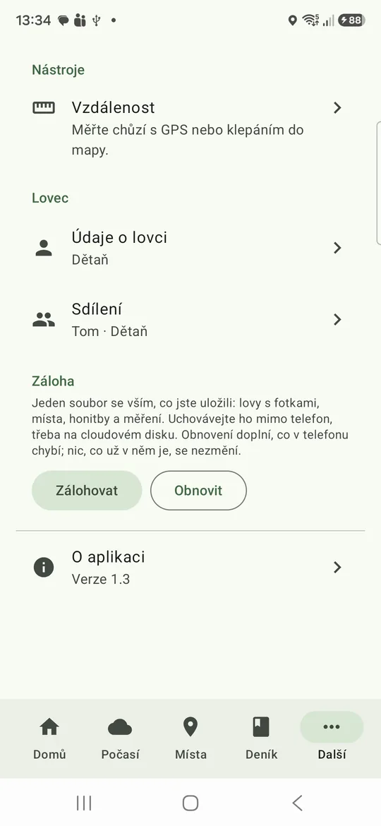
More

Distance, sharing and backup

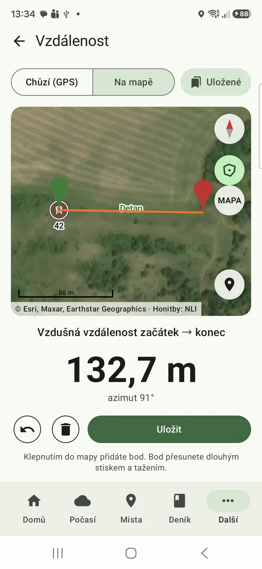
Measure a distance in a straight line: walk it with GPS, or tap points on the map.

Here you also enter your hunter details for kill reports, turn on sharing with your hunting ground, and back up your data.

The More tab: Distance, Hunter details, Sharing, Backup and About.
The Distance tool: two points on a satellite map, 132.7 m apart in a straight line.

Your data stays with you

What you save stays on your phone. The app works without a signal, and the forecast updates when you are online. There are no ads and no analytics, and you need no account.

Back up everything to one ZIP file and keep it in your cloud drive or on a computer. Restore it on a new phone.

Maps: OpenStreetMap and Esri. Weather: Open-Meteo. Czech hunting-ground borders: NLI.